What is MapRun?
MapRun is an Orienteering App that runs on iPhone and Android, the current version is MapRun6 and can be installed on your phone for free.
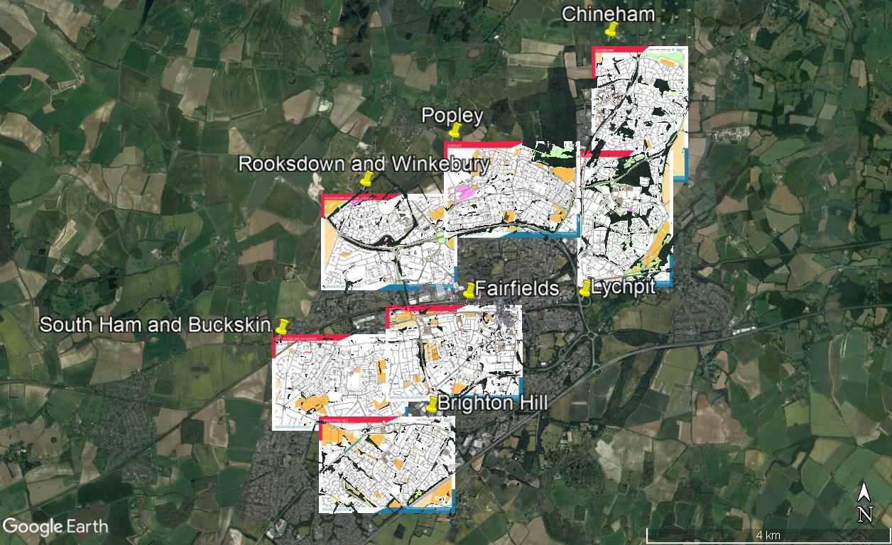
BADO have some areas available on MapRun as detailed on the maps below, the first shows those in Basingstoke and the second where there are runs in Hampshire. Alternatively just go further down the page to see a list of the areas.
Disclaimer: As MapRun are individually run events you run them at your own risk. Neither BADO or British Orienteering can be held liable for any accident or other incident arising while running a MapRun course.

MapRuns in Hampshire in Basingstoke, Andover, Hook and Tadley, click “View Larger Map” to see where we have MapRuns
How to Use MapRun
The best way to understand how to use MapRun is to watch the British Orienteering Video that is on Youtube, the first part is about using MapRun on your mobile, you do not need to watch the second part because that is more for setting up courses:
Getting Paper Maps
The map displays on your phone but most runners prefer to use a hard copy of the map because this enables you to use your normal orienteering skills. The maps are available as PDF’s below (click on links to download) along with further information about the events:
The Line course, straight line 5.7km. Map scale 1:7,500. The start and finish are by Kempshott Village hall because there is lots of parking available there. Street address is Pack Lane, Basingstoke,RG22 5HN.
Please print the paper map to see the various OOB areas that are school grounds. For me, on screen the OOB areas are extended but this is OK once downloaded, just a viewer issue.
The Score event 25 controls, 20 points each, time limit 1 hour. Start and Finish near Kempshott Village Hall, parking as above.
On this version of the map there are no OOB areas needing to be marked.
The Line course, straight line 4.9km. Map scale 1:7,500. Parking is available by the start in Nightingale Gardens, Basingstoke, RG24 9SD without annoying any residents.
The Score course is 30 controls, 20 points each, time limit of 1 hour. Parking as above.
The Line course, straight line 4.8km. Map scale 1:7,500. As the start and finish are in the same place it is possible to start and finish at any control if you wish. If you go the start itself then it is in Guinea Court, Basingstoke, RG24 8XJ, behind the local shops.
The Score course, 25 controls, 20 points each, 1 hour time limit. Parking for Start and Finish as above.
The Line course, straight line 5.3km. Map scale 1:7,500. There is ample parking at the Chineham Shopping Centre off the A33. Please be careful in that area due to the traffic visiting the centre.
The Score Course, 25 controls, 20 points each, time limit 1 hour. Note the start and finish is in a different place, south of the Shopping Centre but parking is in the same place.
The Line course, straight line 5.3km. Map 1:7,500. Marked Start and Finish near to Popley Fields Community Centre where there is parking, Carpenters Down, RG24 9AE. Be careful crossing Carpenters Down and Popley Way, the main feeder roads to the estate.
Download the paper map to note the OOB school grounds. On MapRun there are no routes through the School Grounds so will not affect your run.
The Score Course, 25 controls, 20 points each, 1 hour time limit.
The Line Course, straight line 5.6km. Map scale 1:7,500. Parking is at Morrsions next to the Ring Road for the Start/Finish. This course is enabled for start and finish at any control. Only cross the Ring Road by the bridges, the traffic on the ring road is moving at high speed.
Download the paper map to see the areas marked as OOB.
The Score Course, 25 controls, 20 points each, 1 hour time limit. Parking as above. Please use underpasses or bridges to cross the busy by-pass.
The Line Course, straight line 5.7km. Map scale 1:7,500. Parking is by Asda Brighton Way, Basingstoke, RG22 4EH for the Start/Finish. This course is enabled for start and finish at any control.
Line Course, straight line 5.6km. Map scale 1:7,500. Parking is available at Bishopswood Road Shops, RG26 4HD for the Start/Finish. This course is enabled for start and finish at any control.
45 minute score. Map scale 1:7,500. Start and Finish at Badgers Wood pub, Wolverton Rd, Tadley RG26 5JH.
Line Course, straight line 5.5km. Map scale 1:7,500. Parking is available in the local streets but suggest Upper Drove south of Eardley Avenue SP10 3NB, the Start/Finish is in Eardley Avenue. This course is enabled for start and finish at any control.
Line Course, straight line 6.0km. Map scale 1:7,500. Parking is available at East Anton Sports Ground end of Pavilion Road SP11 6YZ for the Start/Finish. This course is enabled for start and finish at any control.
Download the paper map to see the OOB areas, all school grounds.
Line Course, straight line 5.7km. Map scale 1:7,500.
Parking:- Crossway Manor Car Park, Reading Road, RG27 9EA. 70p for 1 hour.
Start:- 100m north-east of the car park on the east side of the A30 London Road. Please use the pedestrian crossing (next to the Shell garage) to reach the start.
Note:- Please take care crossing the roads around control 10. Use the underpass between 3 and 4.
Line Courses, straight line – Long 5.2km, Short 3.4km. Map scale 1:7,500.
The start on the map is at the Cart & Horses, London Road, Kings Worthy, Winchester, SO23 7QN. If you are using the pub as well, no problem to park there.
Remember, though, for MapRun you can start and finish from any control on the course.
On the Long from 9 to 10 and on the Short from 6 to 7 there is steep embankment that is slippery to climb or go down, best to go round the path route.
